Elm to Sargans: Hike via Foo Pass & Weisstannen — Swiss Alps

 Switzerland
Elm–Sargans hike in Switzerland: mountain panoramas, clear trails, babbling streams and grazing cows — a peaceful alpine experience to remember. Plan now!
When I was deciding where to go in Switzerland, I found a hike from the town of Sargans to the village of Elm. I liked that it’s well signposted, there are places to get refreshments along the way, you can shorten the route by bus if needed, and both villages are linked by train, so it’s easy to get back to your accommodation even late at night.
Accommodation tips
If you’re looking for a place to stay, here’s a list of towns around the route mentioned below:
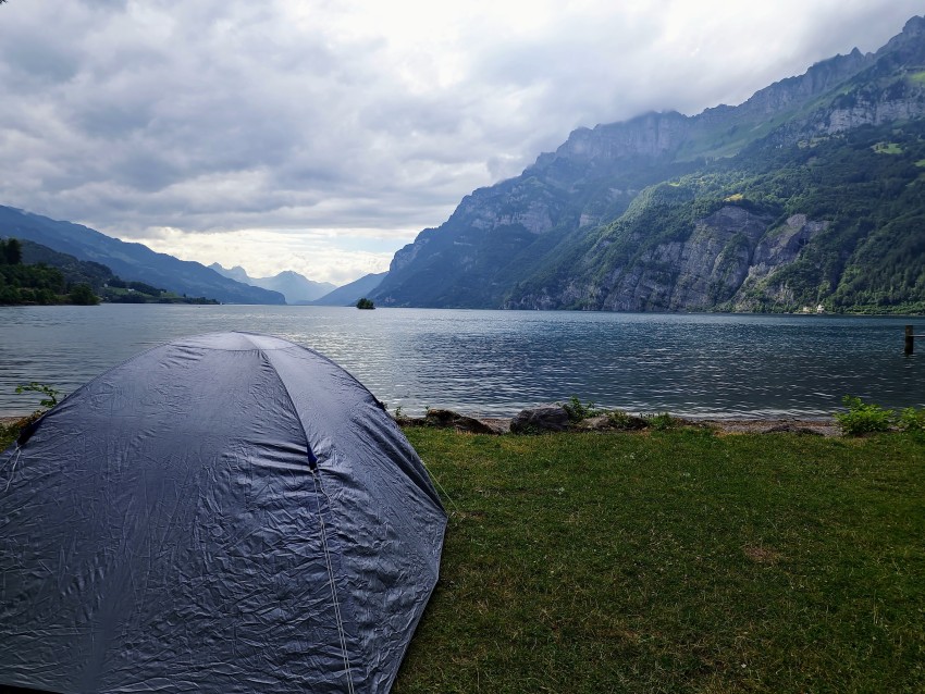
I also recommend checking out the campsiteSee-Campingin Walenstadt. I stayed there. The campsite is clean, reasonably cheap, showers are included, there’s Wi‑Fi, and in the morning you get a beautiful view of the mountains. Cold‑water swimmers can even take a dip.
Route options
I did this hike in June. For a fit, sporty person it takes around 8–11 hours including breaks. It took me about 9 hours. There was no snow. In summer you don’t need any special equipment. In winter I’m not sure — I don’t know how difficult the climb is when the hills are covered in snow.
You can hike the route from Sargans to Elm or the other way around (which was my case). You can also take a bus from Sargans to Weisstannen, or in the opposite direction go from Weisstannen to Sargans. Either way you’ll avoid a fairly long, boring stretch of walking on or alongside the road.
As I wrote above, because of the weather I chose the direction from Elm to Sargans and shortened it to Weisstannen. The highest point on this route is the Foopass, and if I had gone from Sargans to Elm a storm would have hit right at that point. By reversing my direction the storm was behind me; I had a head start, with sunshine and beautiful clear weather ahead of me.
Weather in Switzerland is a bit unpredictable, and after reading tips online and trying a few apps the one that worked best for me wasMeteoblue. Here are four locations it’s good to check before the hike. For a winter trek I’d also check snow depth and whether the trail is passable at all:
The map below marks the route from Elm, over the Foopass, to Sargans. As I said, I recommend shortening the route and starting or finishing in Weisstannen.
For navigation on this route I recommend tryingMapy.com. Compared with Google or other apps, Mapy.com sometimes shows trails even locals don’t know about; you can download maps in advance and use them offline. It’s saved me a lot of trouble more than once.
Start of the route from Elm to Foopass
My hike started in Elm at the train station early in the morning (7:00). I came from Walenstadt. At the station thereare public toilets, which is handy right at the start of a hike.
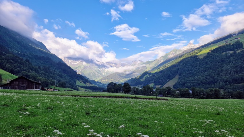
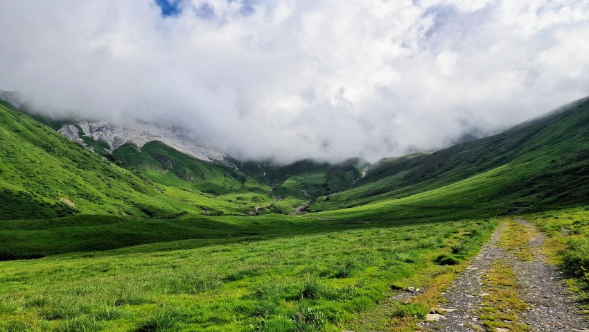
The climb begins on a road uphill. After a while you enter a forest where you start to see the hills and mountains, there’s nobody around and you begin to feel that mountain calm. You’ll walk uphill all the way to the Foopass.
Before the Foopass, the highest point of the route, you’ll come across a small farm. It’s very quiet there, occasionally broken by a cow’s lowing or the sound of bells. In good weather you’ll get a lovely view of the mountain scenery.
There’s nothing like sitting for a while after 2.5 hours of walking and taking in the surroundings. I read online that the farm offers refreshments, but during my visit nobody was there and it was closed.
From the farm it’s about a half‑hour walk uphill to the Foopass along a fairly steep slope.
The route from Foopass to Weisstannen
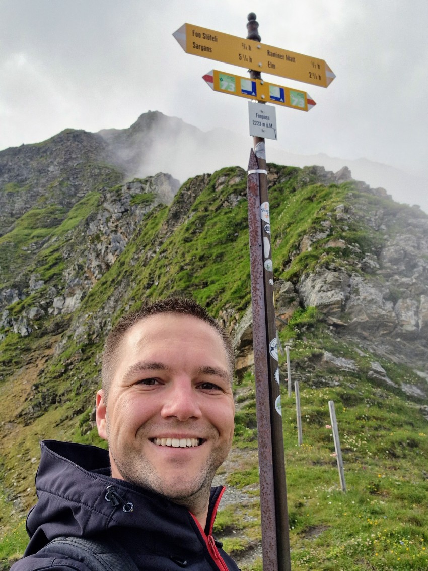
It took me 3 hours to get from Elm to the Foopass (with short breaks). At the top I took a break and watched marmots. The ascent isn’t dangerous, but I recommend watching where you step and having proper mountain‑hiking gear. Be prepared for fog that can roll in within minutes, reducing visibility to only a few meters and forcing you to rely on navigation.
After the break I knew I’d be heading downhill from then on and wondered what else I’d see, because the ascent itself had already been an experience.
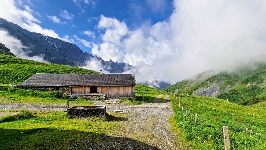
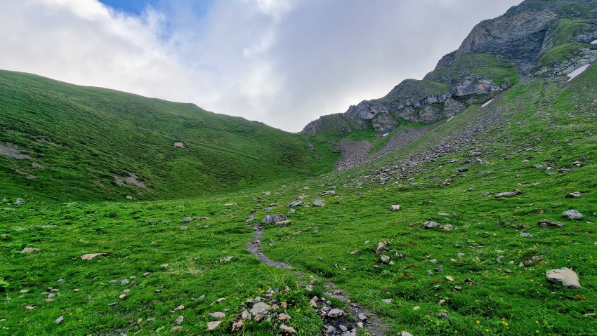
A short way from the Foopass, on the side away from Elm, you’ll come to another farm marked on the map as Alp Foo. The walk there from the Foopass takes about 30 minutes.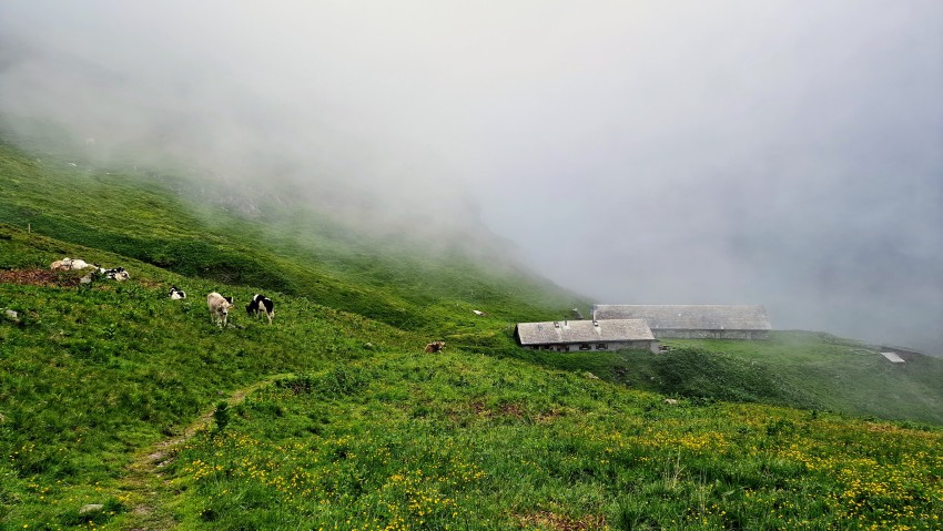
You don’t need to be afraid of cows on the trail. It’s recommended to pass them calmly and at a distance, especially if they have calves nearby.
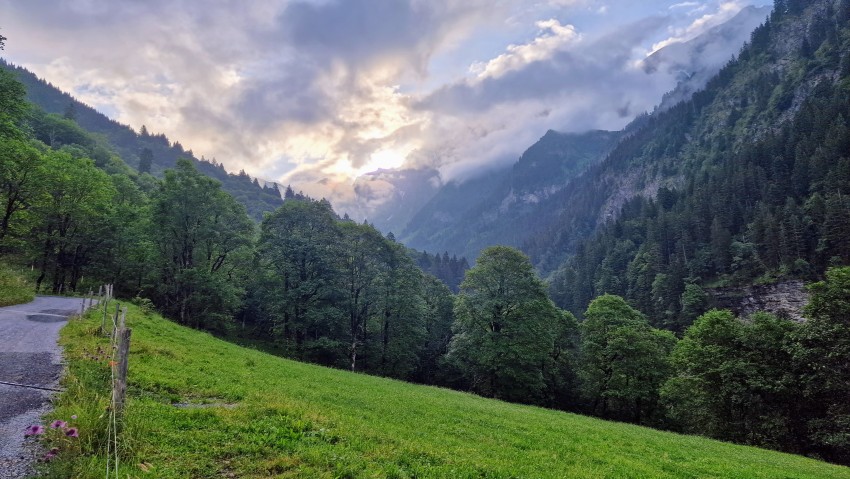
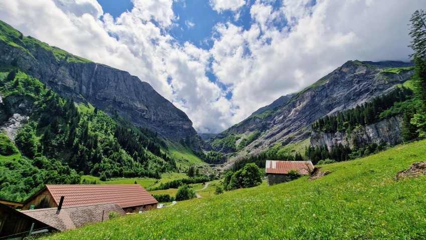
After the farm you’ll face a steep stone staircase with quite little room to maneuver and pass others. Once you descend the steps you’ll see a stream with crystal‑clear water
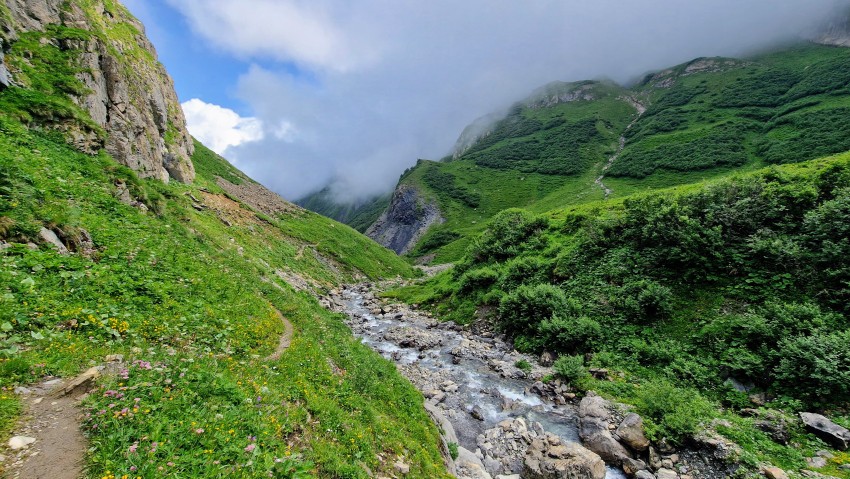
and interesting rock formations along the sides of the mountains.
The path from the stairs toward Weisstannen isn’t difficult — it’s downhill and easy to follow.

If you set out early in the morning, this is where you’ll start meeting hikers coming the opposite way.
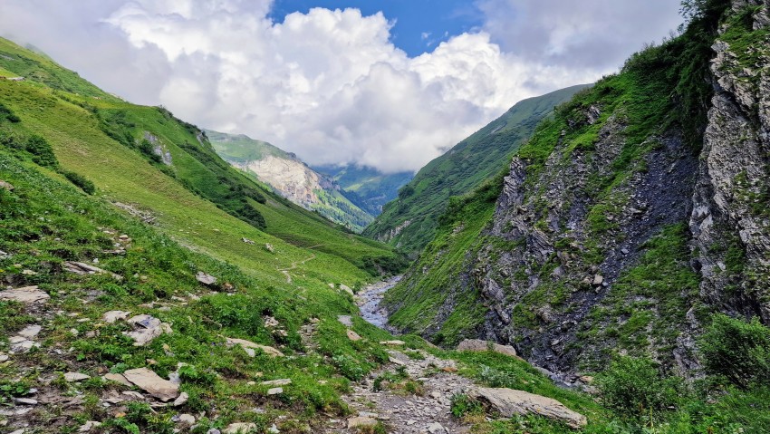
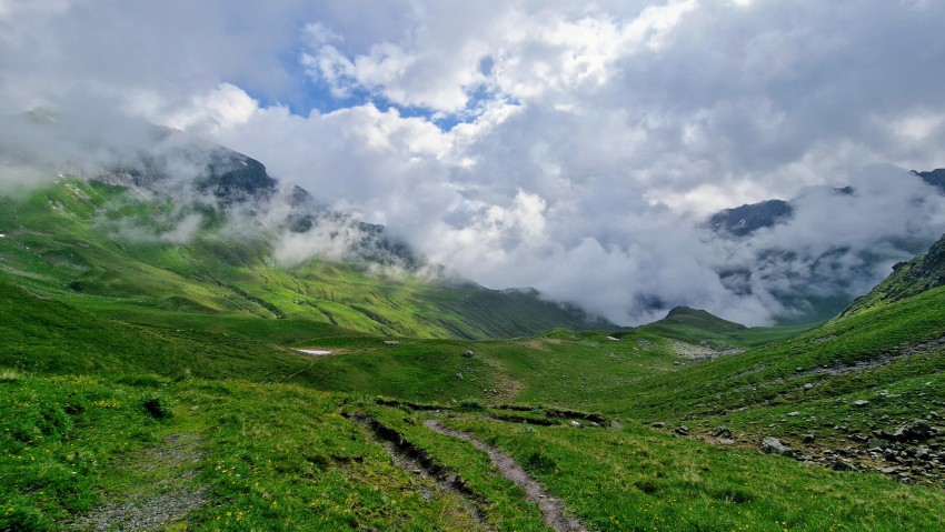
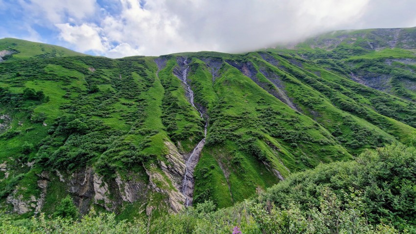
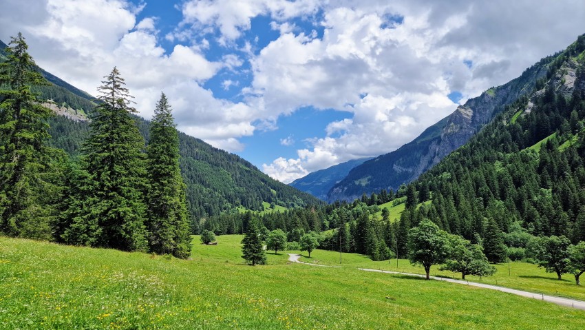
About an hour’s walk from the Foopass a valley view opens up before you that’s truly worth it.
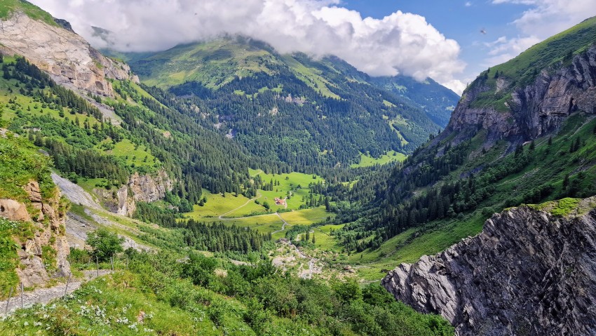
Even if it doesn’t look like it, the route from the viewpoint to the farm still takes almost another hour.
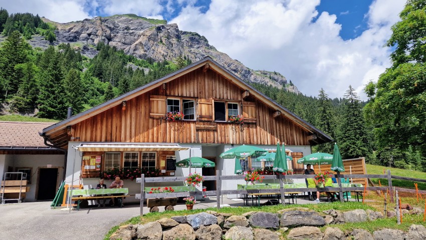
I was really looking forward to sitting down, resting, and having something good to eat and drink. According to information online, the farm also offers overnight stays. Some hikers split the route into two stages: they either camp on the Foopass or stay in one of the huts along the way. I forgot to ask for more details.
Links to hut websites:
- The one from the photo:https://www.alpwalabuetz.ch
- Alp Siez a little further along the trail:https://alpsiez.ch
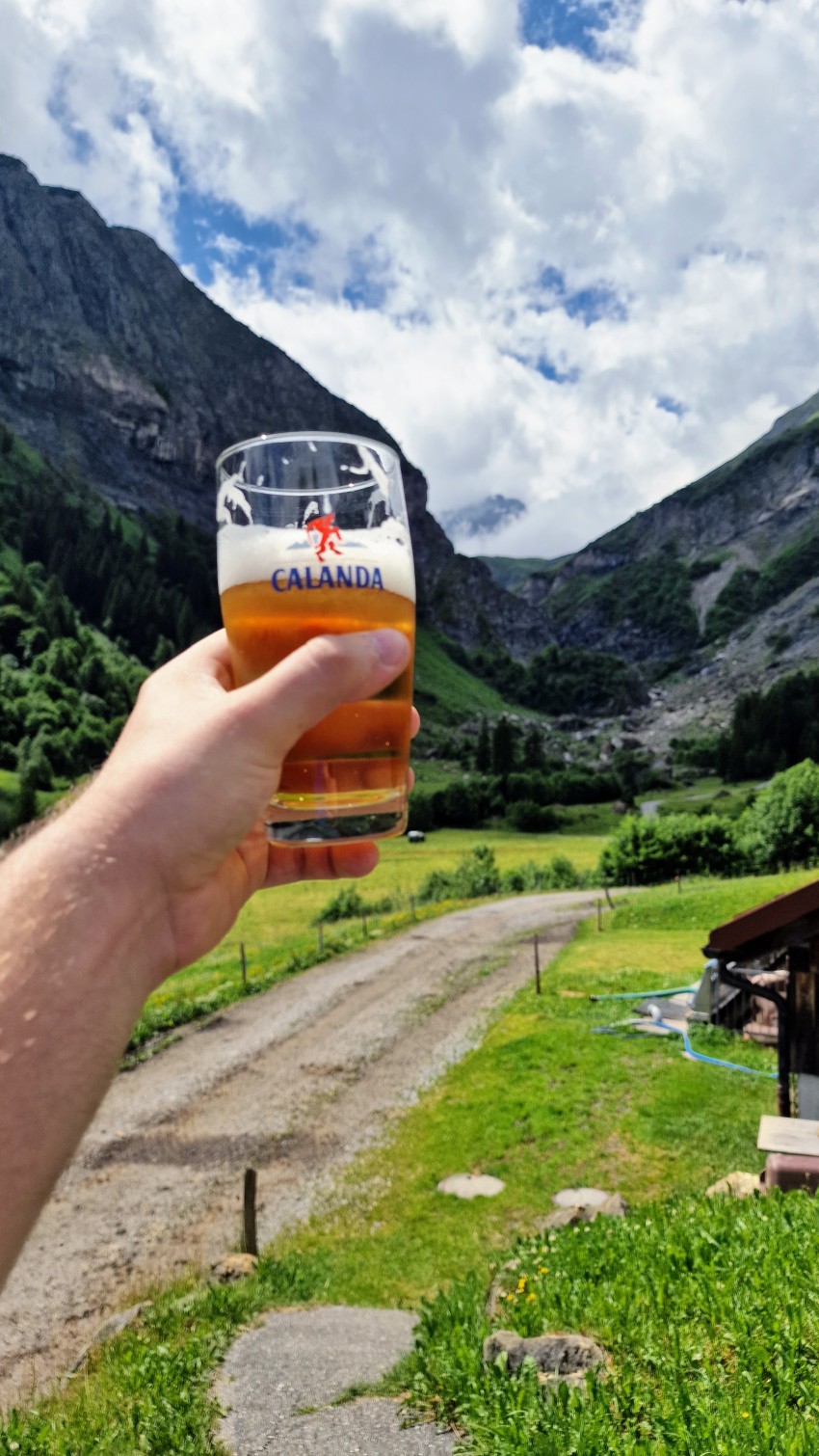
The refreshments on offer are the usual classics: homemade sausages, salamis, bread, hot dogs and drinks like beer or sodas. I really enjoyed the break here, and the view of the pass was priceless...
From the farm to Weisstannen it took me about 2 hours.
Weisstannen and the bus to the town of Sargans
The bus stop from which you can travel to Sargans is shown on the map below. From Sargans I then continued by train to Walenstadt.
Information about bus schedules can be found onRome2Rio.com. I came across Rome2Rio by chance and it’s very useful. I use it whenever I can’t find transport information for the place I’m in.


