Hiking Pilatus Kulm, Switzerland: Routes, Difficulty & Tips
 Switzerland
Hiking to Pilatus Kulm? Find route tips, difficulty, duration, parking, safety advice and scenic highlights — simple tips to enjoy your Pilatus outing.
Routes
The route I chose for the hike to Pilatus Kulm is marked on the map below. It starts in Alpnachstad. The climb up took me about 4 to 5 hours.
Another route you can find online starts in Kriens. I didn't take that route, so I don't know exactly where it goes and can't rate it.
You can find more routes on AllTrails.com.
Weather on the route
Before you set out, I recommend checking the weather — you certainly don't want to hike four hours up a steep hill in rain or strong wind. In Switzerland I used the app Meteoblue.com. You can check the current weather at the summit using a webcam. A webcam is great when you want to see whether there's fog at the top or not.
Parking for the Alpnachstad route
The parking marked on the map below is intended only for the route from Alpnachstad. There's plenty of space (if you arrive around 8:00). The parking is paid — pay at the parking meters.
Cable car and train to Pilatus Kulm
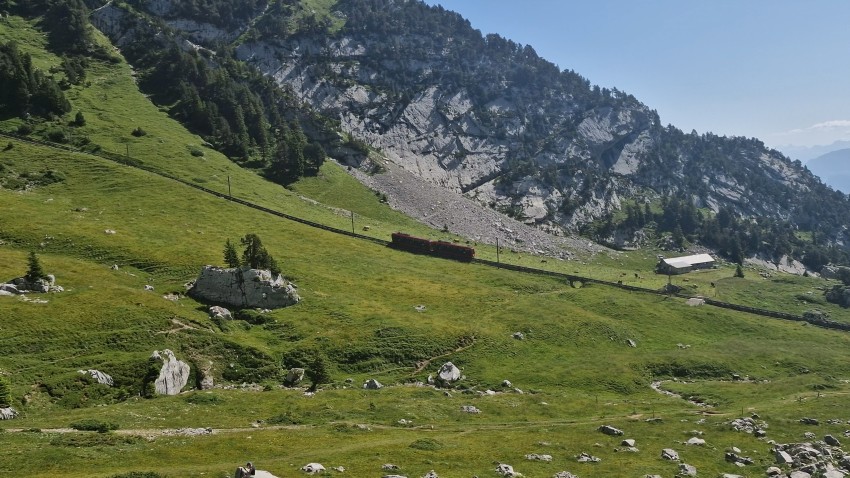
You can reach Pilatus Kulm by train from Alpnachstad or cable car from Kriens. I took the train back to Alpnachstad to save my legs for other planned hikes. If you're deciding whether to take the cable car up or down, in my experience descending steep hills is always harder on the knees... and sore knees will quickly ruin your next planned hikes.
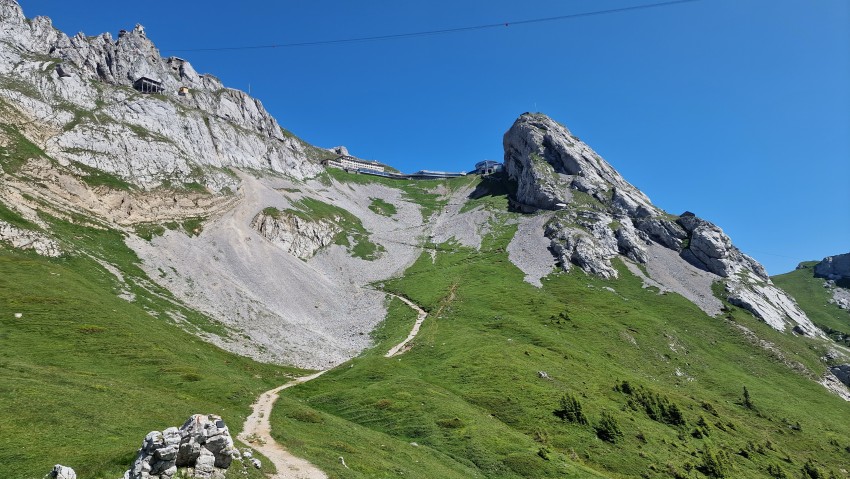
Hike from Alpnachstad to Pilatus Kulm
It's best to start around 8:00 — by around 3:00 PM there were a lot of tourists up there.
The route from the Alpnachstad parking lot to Pilatus Kulm isn't dangerous and there are no obstacles that would prevent ordinary hikers from making the ascent. That said, the hike is physically demanding.
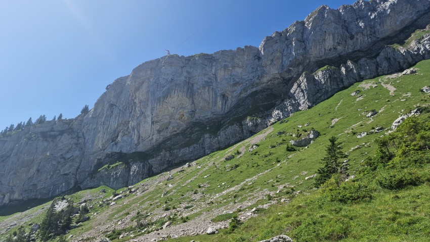
You start in town and walk uphill the whole way, up a fairly steep slope. You'll alternate between dirt, asphalt, rocks and grass and will need to pick the best line. And that last hill — when you can already see Pilatus Kulm but your legs are screaming — feels almost endless.
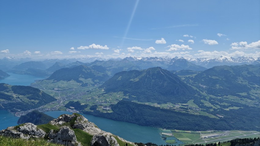
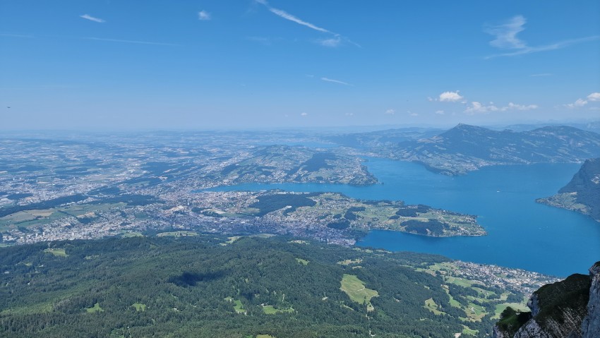
However, up there you'll get a stunning view of the wide surrounding area
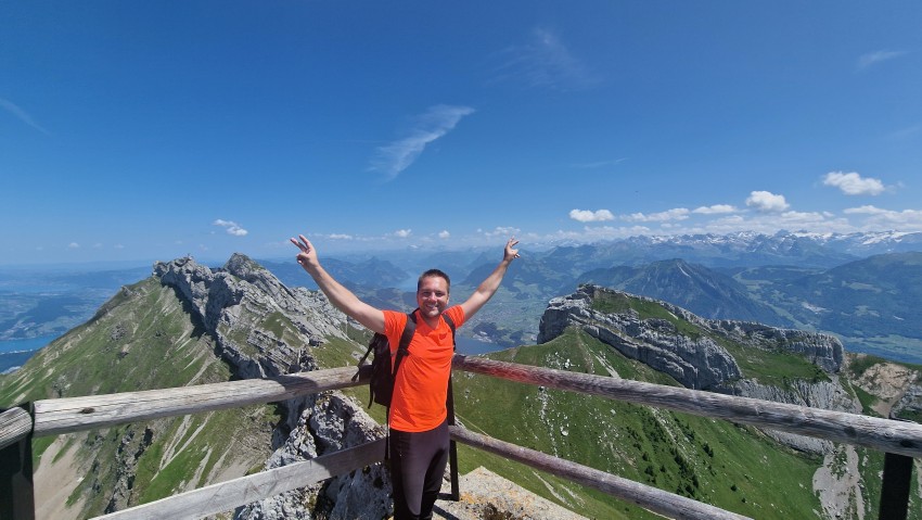
and a well-deserved break.

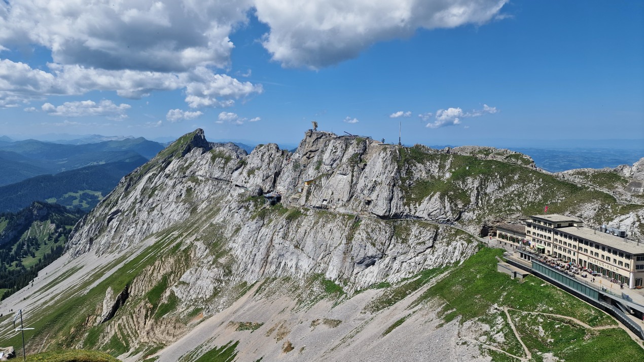
There are several viewpoints at Pilatus Kulm worth walking to — sit on a bench, take in the scenery and relax. If you've climbed the hill, the view really is a reward.
Route to Tomlishorn
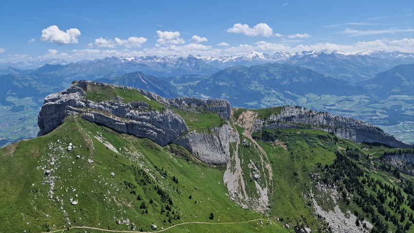
Tomlishorn is the highest peak of the Pilatus massif near Lucerne. It's just under 2 km (about a 30-minute walk) from Pilatus Kulm and offers a beautiful view of the surroundings on both sides of the rocky massif.
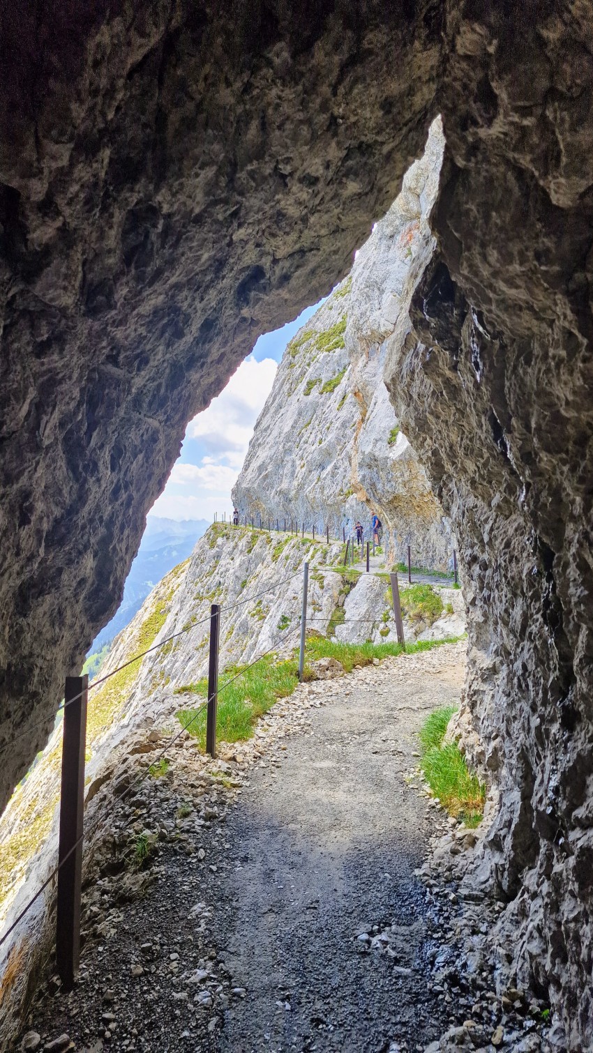
The path from Pilatus Kulm to it follows a reinforced trail secured with steel cables along the sides. I definitely recommend checking it out.
Official site for Pilatus information: Pilatus.ch.
Accommodation tips
Gallery


